
Boat Ramps | Freshwater Ramps: Northwest Region | Northeast Region | North Central Region | Southwest Region | South Region
Rentals: Boat Rentals at Naples Bay Resort | Gulf Shores Marina | Marco River Marina |
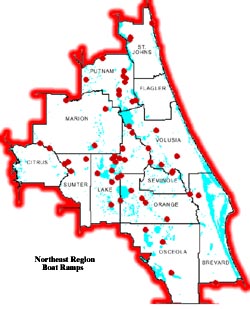
Click on map for an enlarged view
Piers & Boat Ramps
| COUNTY | WATERBODY | PIER LOCATION | BARRIER FREE |
REST- ROOMS |
|---|---|---|---|---|
| Citrus | Lake Tsala Apopka | Inverness Pool | Yes | No |
| Lake | Lake Griffin | Herlong Park at Leesburg | Yes | No |
| Lake | Big Lake Harris | Hickory Point Marina | Yes | Yes |
| Lake | Lake Harris | Singletary Park, S. of Leesburg on US 441 | Yes | Yes |
| Lake | Lake Minneola | Clermont, Florida | No | No |
| Lake | L. Griffin | Fruitland Park, L.Griffin Recreation Area | Yes | Yes |
| Lake | Grasshopper Lake | Ocala Nat. Forest | No | No |
| Lake | Dora Canal | Lake Eustis | No | Yes |
| Lake | Bear Pond | Seminole Forest Wildlife Management Area | Yes | Yes |
| Marion | Lake Eaton | Ocala Nat. Forest | No | No |
| Marion | Ocklawaha R.( Moss B | Moss Bluff | Yes | Yes |
| Marion | Quarry Pond | Ocala Nat. Forest | No | No |
| Marion | Orange Lake | E. of City of Orange Lake | Yes | Yes |
| Orange | Lake Lawne | Barnett Park -Orlando | No | Yes |
| Orange | Clear Lake | Orlando Florida | Yes | Yes |
| Orange | Lake Santiago | Demetree Park in Orlando FL | Yes | Yes |
| Osceola | Lake Tohopekiliga | Neptune Rd.in Kissimmee FL | Yes | No |
| Putnam | St. Johns River | E. Palatka | Yes | No |
| Putnam | Rodman Reservoir | Below dam at Raceway | Yes | Yes |
| Putnam | Rodman Reservoir | Rodman Recreation Area | No | Yes |
| Seminole | Secret Lake | Altamonte Springs | Yes | Yes |
| St. Johns | Lake Ponte Vedra | N. of St. Augustine on A1A | No | No |
| Volusia | St. Johns River | Ed Stone Park | No | Yes |
| Volusia | St. Johns River | Bluffton Recreation Area; Dexter/Mary Farms Unit; Lake George Wildlife Management Area | Yes | No |
Fox Lake (#136)
Heading north on I-95 exit and turn
right onto SR 50. Go 0.5 mile to SR 405. Turn
left on 405 and go 2.2. miles. Then turn left on
Fox Lake Road and go 1.5 miles to Fox Lake
Park entrance. Follow park road to ramp.
Single-lane ramp with courtesy dock. Unimproved parking lot capable of accommodating 20 vehicles. Bathroom and picnic facilities are available. Pier and bank fishing are allowed.
St. Johns River--Hatbill Park (#193)Heading east on SR 46 from intersection of CR 426 and SR 46 in Geneva, go 12.2 miles. Turn right onto Hatbill Road and follow 5.2 miles to ramp at dead-end on road or Hatbill Road is 4.2 miles west of I-95 on SR 46.
Double lane ramp with floating courtesy dock. Unimproved parking lot capable of accommodating 100 vehicles. Bank fishing is allowed. Area unusable at times due to high water.
Withlacoochee River (#70)
At Marion/Citrus
county line head west on SR 200, cross the
Withlacoochee River and turn right onto CR
39. Follow CR 39 for 1.2 miles to Seminole
Lane. Turn right onto Seminole Lane and
follow 0.2 mile to Riverside Way. Turn left and
follow Riverside Way 0.3 mile to ramp on right
side of road.
Single lane ramp with unimproved parking lot capable of accommodating 15 vehicles. Bank fishing is allowed.
Apopka/Beauclaire Canal--Lake Jem Park (#81)
From Tavares go south on SR 19. Turn left
onto 561 and go 1.6 miles to CR 448. Turn left
on CR 448 and go 3.3 miles to park entrance.
Turn left from CR 448 into park and follow
road to ramp.
Single-lane ramp with unimproved parking lot capable of accommodating 20 vehicles. Bank fishing is allowed. Picnic facilities are available.
Johns Lake (#69)Heading east on SR 50 from Clermont, go 4.8 miles from intersection of SR 50 and US 27. Turn right and go 0.1 mile to ramp on left.
Single-lane ramp with floating courtesy dock. Paved and unimproved parking lot capable of accommodating 20 vehicles. Bank fishing is allowed.
Lake Dalhousie (#147)Heading north on SR 19 from Eustis, turn right onto CR 450A (Willis McCall Road) in south end of Umatilla. Go 2.8 miles to intersection of CR 44A and CR 450A. Go right on CR 44A (CR 450A requires a 90 degree turn to left). Go 0.6 mile on CR 44A to Bill Collins Road, turn left and follow 0.9 miles to Burhans Road. Go left and follow 0.7 mile to ramp.
Single-lane ramp with unimproved parking lot capable of accommodating 16 vehicles.
Lake Dora--Gilbert Park (#80)Heading south on U.S. 441 from Mt. Dora, turn right onto Donnelly. Take Donnelly 1.8 miles to Charles Avenue. Turn left on Charles and follow 0.2 mile to Gilbert Park. Turn right into boat ramp entrance.
Three lane ramp with paved and unimproved parking lot capable of accommodating 23 vehicles. Bathroom and picnic facilities are available. Bank fishing is allowed. A marina with fuel is nearby.
Lake Dorr--Lake Dorr USFS (#38)From intersection of SR 40 and 19, go south on SR 19 for 11.7 miles. Turn left onto dirt road (0.3 mile south of U.S. Forest Service Campground entrance of SR 19). Follow road 0.2 mile to ramp.
Single-lane ramp with primitive parking lot capable of accommodating 15 vehicles. Universal accessibility.
Lake Eustis--Tavares Recreation Park (#6)From intersection of 19 and 441 at Tavares go west approximately 1.0 mile to ramp on right.
Double-lane ramp with two fixed courtesy docks. Paved parking lot capable of accommodating 96 vehicles. Picnic and bathroom facilities are available. Pier and bank fishing are allowed. Universal accessibility at normal water levels.
Lake George--Blue Creek Lodge Road (#98)Heading east on SR 40 from intersection of SR 19, go 3.3 miles. Turn left onto Blue Creek Lodge Road and follow for 2.5 miles. Go left onto Lake George Road and go 1.0 mile to ramp at dead end of road.
Single-lane ramp with unimproved parking lot capable of accommodating 6 vehicles. Area experiences seasonal floods and water hyacinths blockage. Shallow water access only.
Lake Harris--Singletary Park (#179)From split of 441 and 27 at Leesburg, go south on 27 for 2.9 miles to entrance.
Double-lane ramp with two fixed courtesy docks. Paved parking lot capable of accommodating 52 vehicles. Pier and bank fishing are allowed. Bathroom facilities are available.
Lake Holly (#97)Head north on SR 19 in Umatilla and turn left onto CR 450. Follow CR 450 3.2 miles. Boat ramp is on right side of road.
Single-lane ramp with unimproved parking lot capable of accommodating 15 vehicles.
Lake Umatilla (#53)Head north on SR 19 from the south end of Umatilla. Go 0.5 mile from the intersection of SR 19 and CR 450A. Turn right onto Lakeview and follow 0.4 mile to ramp on left side of road.
Single-lane ramp with unimproved parking lot capable of accommodating 7 vehicles.
Lake Yale-Lake Yale North (#146)Head north on SR 19 from the south end of Umatilla. Turn left onto CR 450. Follow CR 450 for 1.8 miles to Lake Yale Road. Turn left on Lake Yale Road and go 1.4 miles. Turn left at 'Y' in road and go 0.3 mile. Bear left at 'Y' onto Lake Yale Boat Ramp Road. Follow road to boat ramp.
Single-lane ramp with unimproved parking lot capable of accommodating 10 vehicles.
Lake Yale--Marsh Memorial Park (#130)Yale Retreat Road is 0.5 miles north of SR 44 on CR 452 and 1.5 miles north of the intersection of SR 19 and CR 452.
Double-lane ramp with unimproved parking lot capable of accommodating 20 vehicles. Bank fishing is available.
Little Lake Harris--Astatula Park (#140)Head south on SR 19 from Tavares, turn left onto CR 561 and go 5.6 miles from intersection of SR 19 and CR 561 to Florida Avenue in Astatula. Turn right onto Florida Avenue and go 0.8 mile to ramp.
Single-lane ramp with unimproved parking lot capable of accommodating 9 vehicles.
Palatlakaha River--Palatlakaha Park (#74)U.S. 27 south of Leesburg go 0.3 mile south of U.S. 27 and SR 50 intersection. Turn right onto Hook Street and go 0.3 mile to Lakeshore Drive, Go left and follow road 3.3 miles to Hull Road. Turn left and follow road 1.1 miles to park on left side of Hull Road.
Single-lane ramp with floating courtesy dock. Unimproved parking lot capable of accommodating 16 vehicles. Bank fishing is allowed.
St. Johns River--Astor-Butler Street (#52)Head east on SR 40 from intersection of SR 19 and SR 40. Go 7.4 miles to Astor. Turn right onto Butler Street and follow 0.2 miles to ramp on right.
Double-lane ramp with floating courtesy dock. Improved parking lot capable of accommodating 35 vehicles. Several marinas are nearby.
Lake Kerr--Moorehead Park (#25)
Head east on
SR 40 from Silver Springs, turn left onto CR
314. Take 314 for 15.4 miles to Forest Road
No 88. Turn left onto Forest Road 88 and go
3.8 miles to NE 140th Street. Turn right and
follow 0.4 mile to ramp.
Single-lane ramp with paved parking lot capable of accommodating 9 vehicles. Bank fishing is allowed. Bathroom and picnic facilities are available.
Lake Weir--Hampton Beach (#26)From intersection of CR 25 and CR 464 in Oklawaha, take CR 25 east 2.7 miles to SE 134th Street Road. Turn right and follow 0.1 mile to park entrance. Take park road to ramp.
Double-lane ramp with courtesy dock. Unimproved parking lot capable of accommodating 10 vehicles. Bathroom and picnic facilities are available.
Orange Lake--Heagy Burry Park (#142)Head north on U.S. Hwy 441/301 from Ocala. Bear left onto 441 when 301 forks to the right. Go 7.6 miles from the fork to NW 191st Place. Turn right and follow 0.7 mile to ramp at end of road.
Single-lane ramp with unimproved parking lot capable of accommodating 28 vehicles. Bank fishing is allowed and fuel is available at nearby fish camp.
Withlacoochee River--Dunnellon (#32)Head south on U.S. Hwy 41 in Dunnellon. Go 0.3 mile from the intersection of U.S. Hwy 41 and CR 484. Ramp will be on the right before the bridge.
Single-lane ramp with unimproved parking lot capable of accommodating 18 vehicles. Bank fishing is allowed.
Clear Lake--George Barker Jr. Park (#109)
Head
south on U.S. 441 from Apopka. Go 1.5 miles
from the intersection of U.S. 441 (Orange
Blossom Trail) and SR 50 (Colonial Drive) to
Gore Street. Turn right on Gore and go 0.5
mile and bear right to traffic light. Turn left and
go one block to Gore. Turn right and
immediately left into George Barker Park.
Single-lane ramp with floating courtesy dock. Paved parking lot capable of accommodating 20 vehicles. Picnic facilities are available and bank fishing is allowed.
Lake Apopka--Magnolia Park (#67)Head south on U.S. 441 south of Zellwood and turn right on CR 437 in Plymouth. Follow CR 437 for 5.2 miles to Magnolia Park. Turn right into park entrance and follow road to ramp.
Double-lane ramp with fixed courtesy dock. Paved parking lot capable of accommodating 22 vehicles. Bathroom and picnic facilities are available.
Lake Lawne--Gordon Barnett Park (#185)Head west on SR 50 from intersection of U.S. 441 and SR 50. Go 2.8 miles to Gordon Barnett Park signs. Turn right and follow curving road 0.6 mile to stop sign and park entrance. Turn right and go to second stop sign. Go straight to third stop sign. Turn right and boat ramp entrance is on left.
Double-lane ramp with floating courtesy dock. Paved parking lot capable of accommodating 27 vehicles. Bathroom and picnic facilities are available. Pier and bank fishing are allowed. Park is open 8 a.m. to 8 p.m.
Lakes Mary Jane & Hart--Moss Park (#68)Head east on 192 in St. Cloud from intersection of CR 523 and 192. Go 2.9 miles to CR 15 (Narcoosee Road), turn left and go 12.4 miles to Moss Park Road. (Note: Moss Park Road is north of Toll Road 417) Turn right onto Moss Park Road and follow east then south to park entrance. Boat ramp is left of park office.
Double-lane ramp with unimproved parking lot capable of accommodating 30 vehicles. Bathroom, shower, picnic and camping facilities are available. Pier and bank fishing is allowed. Park is open between 8 a.m. and 6 p.m. to day visitors.
Alligator Lake--C-33 Canal (#13)
From St. Cloud,
go east on Hwy 192 to CR 534 (Hickory Tree
Road) 0.8 mile. Travel south on Hickory Tree
Road for approximately 6.0 miles. Turn left
into county park. Follow park road to ramp.
Single-lane ramp with fixed courtesy dock. Unimproved parking lot capable of accommodating 8 vehicles. Picnic facilities are available and bank fishing is allowed. Universally accessible at normal water levels.
Lake Jackson--Three Lakes WMA (#178)From intersection of Hwy 192 and 523 (Vermont Avenue) in St. Cloud, travel south on 523 for approximately 25.8 miles to main entrance to Three Lakes Wildlife Management Area. (Note: This is second entrance). Turn right and follow unpaved road for 2.0 miles. Road forks - bear right and follow road 1.1 mile to ramp.
Single-lane ramp with unimproved parking lot capable of accommodating 8 vehicles. Picnic facilities are available. Bank fishing is allowed. Facility is universally accessible.
Lake Tohopekaliga--Lakefront Park (#125)From intersection of Hwy 192 and Hwy 441/17-92 in Kissimmee, travel south on Main Street 0.6 mile to Monument Avenue. Turn left onto Monument Avenue and follow to Lakeshore Blvd. Turn right on Lakeshore and follow 0.3 mile to ramp on left.
Six-lane ramp with floating courtesy dock. Paved parking lot capable of accommodating 84 vehicles. Additional parking is available across street in unimproved lot. Bathroom and picnic facilities are available. Pier and bank fishing is allowed. A marina is located approximately 0.5 mile east of ramp.
Cowpen Lake (#19)
From SR 20 and CR 315 in
Interlachen, go west on SR 20 approximately
8.25 miles to West Cowpen Lake Road. Turn
left and go to T intersection and turn left to
ramp.
Ramp is not useable when water levels are low.
Crescent Lake (#112)Head north on Highway 17 in Crescent City. Turn right onto Central Avenue and go about 3 blocks. Ramp is at end of road.
Single-lane ramp with unimproved parking lot capable of accommodating 6 vehicles. Bank fishing is allowed.
George's Lake (#144)From intersection of SR 315 and SR 100, go east on SR 100 to Florahome. Turn left onto Coral Farms Road. At South Bellamy Road turn right and go 1.5 miles (until pavement ends) and turn right onto boat ramp road. Road dead ends at ramp.
Single-lane ramp with unimproved parking lot capable of accommodating 12 vehicles. Bank fishing is allowed.
Lake Stella (#165)Head north on U.S. Hwy 17 toward Crescent City, turn left onto Central Avenue. Go about 2 blocks. Ramp is at end of road.
Single-lane ramp with fixed courtesy dock. Unimproved parking lot capable of accommodating 12 vehicles. A fishing pier is present.
St. Johns River--Palatka Ramp (#54)Head east on U.S. Hwy 17 (SR 100 and SR 20) in town of Palatka, turn right onto 3rd Street. Go approximately 3 blocks to park entrance on left. Note: 3rd Street is also marked as River Street.
Double-lane ramp with paved parking lot capable of accommodating 28 vehicles. Bathroom and picnic facilities are available and a fishing pier is present.
St. Johns River--Palmetto Bluff (#85)Head north on U.S. Hwy 17 from Palatka, go to Bostwick. Turn right onto Palmetto Bluff Road (CR 209) - (do not take 1st CR 209 approximately 3.5 miles north of Palatka.). Go 4.5 miles to Cedar Creek Road. Turn left and go one block, Turn left onto boat ramp road (unpaved). Go one block and turn right. Follow road to ramp.
Single-lane ramp with unimproved parking lot capable of accommodating 10 vehicles.
St. Johns River--Shell Harbor (#127)Head south on U.S. Hwy 17. Turn right onto CR 309 near Satsuma. Follow CR 309 for 2.6 miles to Shell Harbor Road. Turn right on Shell Harbor and follow 0.3 mile to ramp at end of road.
Single-lane ramp with unimproved parking capable of accommodating 10 vehicles.
St. Johns River--Welaka (#128)Head south on CR 309 from Palatka. Turn right onto Elm Street (only traffic light) in Welaka. Follow road to ramp.
Single-lane ramp with unimproved parking capable of accommodating 8 vehicles.
St. Johns River--East Palatka (#126)Head east on U.S. Hwy 17 in east Palatka from the eastern end of Memorial Bridge, go 1.9 miles, turn right on Pico Road and follow road 0.2 mile to ramp at end of road.
Single-lane ramp with unimproved parking capable of accommodating 20 vehicles.
St. Johns River--Elgin Grove (#30)Head north on SR 207 from intersection of SR 207 and SR 100. Go 4.1 miles to SR 207A. Turn left on SR 207A and follow 4.3 miles to East River Road. Turn left and go one block to Magnolia Avenue. Turn right and follow Magnolia Avenue 0.4 mile to ramp at end of road.
Single-lane ramp with unimproved parking capable of accommodating 10 vehicles.
St. Johns River--Palmo Cove (#77)
Head south
on SR 13 from Duval/St. John's county line,
continue south 1.2 miles from intersection of
SR 16 and SR 13. Turn right onto Palmo Fish
Camp Road. Go 1.9 miles to ramp at end of
road.
Single-lane ramp with unimproved parking lot capable of accommodating 5 vehicles.
Trout Creek--Trout Creek Park (#181)Head east on SR 16 from county line, from Green Cove Springs, Cross St. Johns River and continue to intersection of SR 16 and SR 13. Turn right on SR 13 and go 2.7 miles to Trout Creek Park. Turn left and follow paved park road to ramp.
Double-lane ramp with courtesy pier. Unimproved parking lot capable of accommodating 25 vehicles. Pier and bank fishing is allowed. This facility is universally accessible at normal water levels.
St. Johns River--Mullet Lake Park (#51)
From
Sanford Head east on SR 46. Go 4.2 miles to
Mullet Lake Park Road. Take a right and
follow 2.2 miles to ramp on left side of road.
Single-lane ramp with paved parking Lot capable of accommodating 12 vehicles. Bathroom and picnic facilities are available. Pier and bank fishing is allowed.
Lake Miona (#61)
Head south on U.S. 301 from
Belleview. Go to Oxford. Continue south on
U.S. 301 for 1.3 miles from the intersection of
CR 466 and U.S. 301 in Oxford to CR 472.
Turn left onto CR 472 and go 2.0 miles. Turn
right into park and follow road to ramp.
Single-lane ramp with improved parking lot capable of accommodating 20 vehicles. Bank fishing is allowed and picnic facilities are available.
Outlet River--Marsh Bend Park (#28)From Wildwood head west on SR 44 (Wildwood Interchange). Turn left onto CR 470 and go 4.8 miles to Outlet Park entrance. Turn right and follow road to ramp.
Double-lane ramp with paved parking lot capable of accommodating 11 vehicles. Picnic facilities are available and bank fishing is allowed. CAUTION, ONLY 9 FEET OF CLEARANCE BETWEEN RIVER AND BRIDGE, EAST OF RAMP.
Withlacoochee River--Carlson's Landing (#166)Head west on SR 44 from Wildwood and turn left onto CR 470. Go 2.7 miles and turn right onto CR 307. Go 1 block and turn right onto CR 300. Go 0.3 mile and turn left onto NW 46th Road and follow road to ramp.
Single-lane ramp with small fixed courtesy dock. Improved parking lot capable of accommodating 7 vehicles. Bank fishing is allowed.
Withlacoochee River--SR 44 Bridge (#138)Head west on SR 44 from Wildwood, go 11.6 miles to ramp. Ramp is on left side of the SR 44 bridge.
Single-lane ramp with unimproved parking lot capable of accommodating 12 vehicles. Bank fishing is allowed. CAUTION: ONCE ON THE WATER, THERE IS LOW CLEARANCE AT SEVERAL BRIDGES IN THE AREA.
Lake Ashby (#49)
From intersection of SR 415 and
Enterprise-Osteen Road in town of Osteen, go
north on SR 415 for 8.0 miles to Lake Ashby
Road. Turn right and follow 0.5 mile. Turn
right onto unpaved road and follow to ramp at
dead-end of road.
Single-lane ramp with unimproved parking lot capable of accommodating 6 vehicles. Bank fishing is allowed.
Lake Dias (#137)Heading east on SR 40 from Astor, go 13.5 miles to SR 11 (6.8 miles from Barberville). Turn right onto Hwy 11 and go 4.0 miles. Turn right onto paved road and follow to ramp.
Double-lane ramp with floating courtesy dock. Paved parking lot capable of accommodating 15 vehicles. Bathroom and picnic facilities are available and bank fishing is allowed. Universally accessible at normal water levels.
St. Johns River--Ed Stone Park (#196)In Deland, going west on SR 44 from intersection of U.S. 17-92 and SR 44. Go through town and continue on SR 44 for 5.3 miles to Ed Stone Park. Entrance is on right before crossing bridge.
Six-lane ramp with courtesy docks. Semi-improved parking lot capable of accommodating 95 vehicles. Bathroom and picnic facilities are available and bank fishing is allowed. Several marinas with food and fueling facilities are nearby.
St. Johns River/Lake Monroe--Enterprise (#35)Hearing south from DeBary on 17-92, turn left onto Dirkson Drive (Enterprise Road). Go 3.2 miles to Main Street in town of Enterprise. Turn right onto Main Street and follow one block to Lakeshore Drive. Turn left onto Lakeshore Drive and follow 1.1 miles to ramp on right.
Single-lane ramp with unimproved parking lot capable of accommodating 8 vehicles. CAUTION: PARKING AREA IS SMALL. WATCH FOR CROSSING TRAFFIC ON LAKESHORE DRIVE.
St. Johns River-High Banks Road (#56)Heading south on 17-92 in Debary, turn right onto High Banks Road. Follow 2.9 miles to ramp where High Banks Road dead-ends at ramp.
Single-lane ramp with unimproved parking lot capable of accommodating 15 vehicles. There is a marina and campground nearby.
St. Johns River--Lemon Bluff (#114)Heading south on CR 415 from Osteen (intersection of 415 and Enterprise-Osteen Road), go 1.5 miles. Turn left onto Lemon Bluff Road. Follow 3.7 miles and boat ramp will be on the right.
Single-lane ramp with unimproved parking lot capable of accommodating 4 vehicles.